Kerameikos - City Walls
Kerameikos was called the area around the city’s western part of the wall. Kerameikos border from the east was the Agora (Inner Kerameikos) and from the west, outside the wall (Outer Kerameikos), was the biggest and most important cemetery. In there were buried the soldiers killed in battles along with the most important Athenians. The name Kerameikos was probably derived from the many pottery makers (Kerameis) who lived there.
The Temistoclean Wall
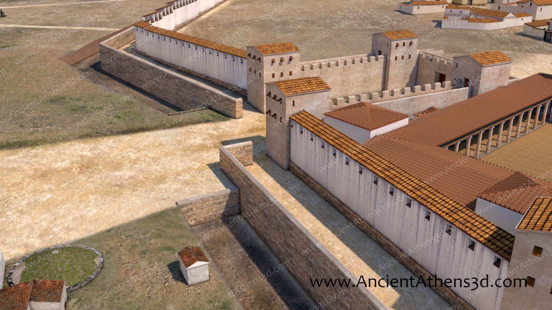
The two parts of Kerameikos were divided by the western part of the city’s circuit wall that was constructed by Themistocles in 479 BC immediately after the Persian Wars. It had a total length of 6500 metres, height 8-10 m, width 3m and had at least 13 gates. The most important of the gates were in Kerameikos. The northern and biggest one was the Dipylon. Its name, meaning “two-gates” was derived from its shape, two gates among four towers for best defense. Its older name was “Thriasiai Pylai” and from there begun the road that led to the Plato’s Academy, Piraeus, Eleusis, and Peloponnesus in general.
The second gate in Kerameikos was also important. It was the Sacred Gate from where the Sacred Way passed, leading to Eleusis. From there began a 22 kilometres procession in the day of Eleusinia feast. From the same gate passes the small river Eridanos.
The wall of Athens had a triple fortification. An attacker would initially be confronted with an moat about 8-9 meters deep, then a small wall about 5-6 meters high, the so-called “proteichisma” and finally the city walls themselves with their towers and battlements. During the Hellenistic period, the towers were equipped with various war machines such as catapults.
The city was fortified with more walls. In 459 BC Cimon began the construction of the Long Walls. He built the Northern and the Phalericon Walls. Between 446 and 443 BC Pericles built the Southern Long Wall parallel to the Northern and so the Phalericon was no used any more. The Long Walls connected Athens to Piraeus. They were 6 kilometres long each and the distance between the two was almost 200 metres. Today their lines are followed exactly by Peiraios street (Northern) and a part of the Metro Line 1 (Southern).
In Dipylon, on the inner side of the walls, there was a large fountain. It was located at an important part of the city, quenching the thirst of travelers. It was probably built in two phases, with the second dating between 350 and 325 BC and uses columns from an unknown building of the Themistoclean period.The Athenians had to destroy their fortifications after their defeat in the Peloponnesian war. But soon, when the democracy was reestablished, Conon repaired the walls in 394 BC and another reinforcement took place in 338 BC when Athens was about to face the Macedonian danger. In 86 BC, Roman general Sylla invaded the city after breaching the wall in the area of Kerameikos.
The walls were abandoned for the entire Roman period until the middle of the 3rd century AD. when due to the danger of barbaric raids, a major repair and expansion of the wall to the east was undertaken (Valerian wall). However, the wall was too large to be adequately guarded and the invasion of the Heruli in 267 leveled the city. After the disaster, the Athenians built a very small wall, with the ruins of the city, north of the Acropolis, the so-called Postherulian wall. The last major repair of the wall took place during the reign of Justinian, in the 6th century AD. The entire precinct of the city was repaired and reinforced with new towers. In the following centuries, however, the wall was permanently abandoned and gradually disappeared. Until the beginning of the 19th century, however, when Athens became the capital of the new Greek State, some parts were visible, but they were either destroyed or buried due to the newer construction work.The Pompieion


